The Gaon of Vilna Dreams of the Holy Land
Zack Rothbart

Few rabbinic figures defy categorization quite like Rabbi Elijah ben Solomon Zalman (1720–97), better known as the Vilna Gaon. One of the most important rabbis and legal authorities of the past few centuries, his intellectual pursuits also branched into a range of secular topics, driven by his burning desire to attain a broader and deeper understanding of the Torah and to fulfill its commandments.
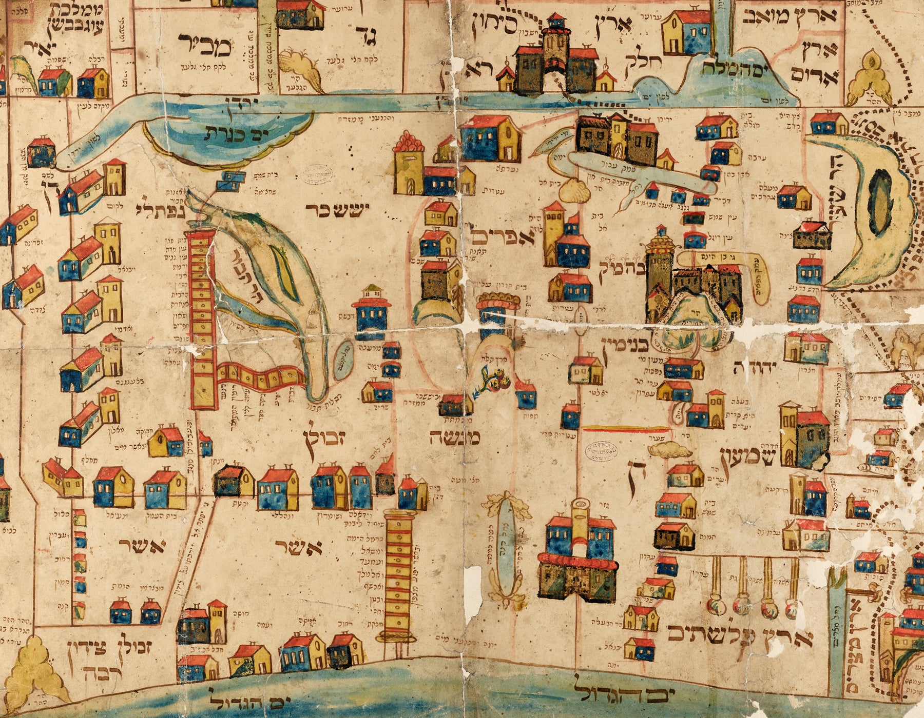
This same passion inspired the Vilna Gaon’s particular interest in the Land of Israel, where he dreamed of moving one day. He wrote a work about the region’s geography according to the Book of Joshua and even dabbled in cartography as a means of better grasping biblical and rabbinic texts.
The Vilna Gaon’s grandson, Rabbi Jacob Moses of Slonim, is said to have drawn the map appearing here in or around 1802 based on one created by his grandfather. The map is oriented toward the east and draws inspiration from traditional Jewish texts rather than from accurate cartographic methods. It features the allotted tribal areas, important cities and towns, bodies of water, and even a dotted line representing the wanderings of the Israelites in the desert. Images of the Temple and other structures reflect contemporary European architecture, while the motif used to represent mountains apparently derives from early Islamic cartography. Mount Moriah looks like a pear, cities in the Asher and Naphtali regions are represented as drawer-like constructs, and the Philistine cities look like matches.
The Vilna Gaon himself never made it to the Land of Israel. However, shortly after his death, around 500 of his followers, inspired by his teachings, made the journey. They initially settled in the Galilee, with a significant number coming to Jerusalem a few years later.


,%20better%20known%20as%20the%20Vilna%20Gaon.%20One%20of%20the%20most%20important%20rabbis%20and%20legal%20authorities%20...)